

Article details
1. Introduction: The Gap Between Model and Site
Over the past decade, Building Information Modeling (BIM) has revolutionized the architecture, engineering, and construction (AEC) industry. Detailed, data-rich 3D digital models now serve as the single source of truth during design and pre-construction planning. However, a persistent challenge remains at the construction site: translating a complex 3D digital model onto a 2D sheet of paper or a flat tablet screen, and then manually executing it in the physical world.
Traditionally, field crews must interpret multi-layered 2D floor plans, elevation cuts, and mechanical drawings to position structural rebar, place anchors, and route complex MEP (Mechanical, Electrical, Plumbing) pipework. This manual translation is inherently prone to human error, spatial misinterpretation, and misalignment—frequently leading to costly spatial clashes, re-work, and project delays.
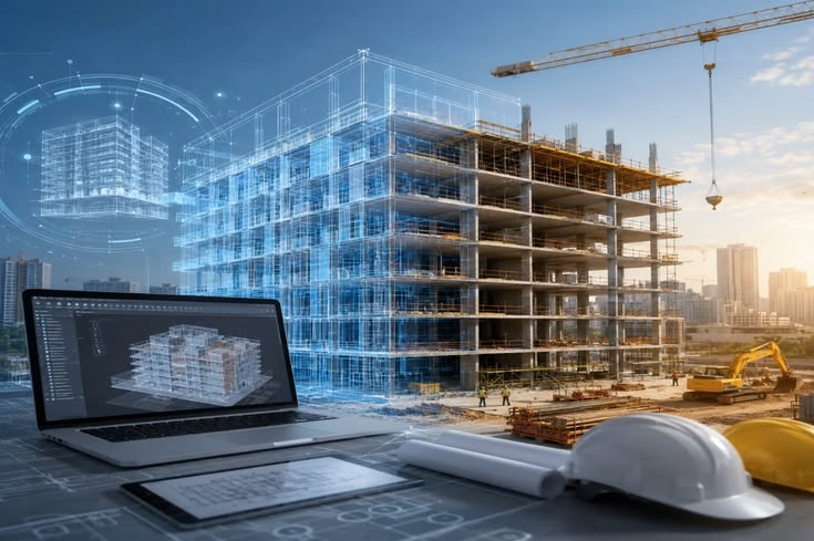
BIM-to-Field Integration via Augmented Reality (AR) and Wearables closes this gap by projecting federated 3D BIM models directly onto the physical job site in real time, at a 1:1 scale.
2. Technical Mechanism: How BIM-to-Field AR Works
Integrating BIM with field-ready AR technology requires precise spatial tracking, real-time rendering, and low-latency hardware to anchor virtual geometry accurately within a physical, dynamic job site.
A. Spatial Anchoring and Georeferencing
To ensure digital elements (such as a 3D HVAC duct or steel connection) line up precisely with built components, AR headsets and tablets utilize a blend of spatial tracking systems:
SLAM (Simultaneous Localization and Mapping): Onboard optical sensors continuously map the geometry of the surrounding physical environment in real time.
Visual QR/Optical Markers: Pre-surveyed physical target markers placed at known site coordinates align the digital origin of the BIM model with the physical site grid.
RTK-GPS & Aerial LiDAR: For large outdoor civil and highway projects, Real-Time Kinematic GNSS positioning provides centimeter-level georeferencing for underground utility or structural alignment.
B. Hardware Form Factors
Head-Mounted Wearables (Smart Hardhats / Smart Glasses): Wearable devices—such as safety-rated AR headsets integrated into hardhats—keep hands free for site engineers and field workers, allowing them to inspect and assemble while looking directly at holographic model overlays.
Mobile AR Devices & Field Tablets: High-end rugged tablets equipped with built-in LiDAR sensors allow foremen to quickly scan a room, overlay digital models, and flag discrepancies.
3. Practical Applications on the Construction Site
Deploying AR wearables on job sites transforms how quality assurance, assembly verification, and safety inspections are conducted:
A. Clash Prevention Before Concrete Pours
One of the most critical applications is verifying underground utilities, sleeves, and rebar layouts prior to casting concrete. A field supervisor wearing an AR headset can look down at a prepared formwork bed and immediately see holographic representations of underground conduits, drainage lines, and anchor bolts. If an electrical conduit was installed 100 mm off-grid, the AR overlay highlights the discrepancy immediately—preventing an expensive core-drilling operation after the concrete cures.
B. MEP Routing and Installation Guidance
Complex mechanical rooms feature tight clear-span constraints with dozens of intersecting pipes, cable trays, and ductwork. AR wearables allow MEP installers to see the exact target routing projected directly in space. By following the 3D holographic guide, technicians assemble components faster, with higher precision, and without stopping to consult 2D plans.
C. Digital As-Builts and Progress Tracking
Instead of waiting until project completion to perform manual as-built surveys, AR devices allow continuous digital QA/QC. Field personnel can compare "As-Designed" BIM geometry against "As-Built" physical conditions on-site, capture georeferenced 3D spatial photos of discrepancies, and automatically log RFI (Request for Information) tickets into project management software (such as Autodesk Construction Cloud or Procore).
Conclusion
BIM-to-Field integration through Augmented Reality and wearable technology is reshaping construction site management. By converting static 3D digital models into dynamic, 1:1 scale holographic overlays in the field, civil engineers, contractors, and field crews can catch alignment errors instantly, streamline complex MEP installations, and drastically reduce costly re-work. Embracing AR wearables transforms the construction site from a place of constant manual interpretation into an efficient, data-guided environment.