

Article details
1. Introduction & The Challenge of Mountain Hazards
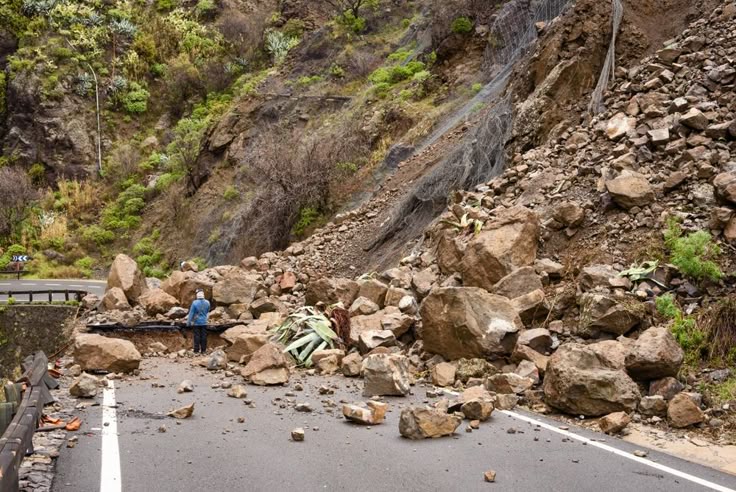
Mountainous regions host critical transportation networks, energy transmission lines, and residential settlements. However, these rugged terrains are inherently vulnerable to landslides and slope failures, triggered by heavy seasonal monsoon rains, seismic activity, or human-induced slope undercutting during construction.
Traditionally, evaluating slope stability relied on localized limit-equilibrium methods (such as the Bishop or Fellenius methods) applied to specific cross-sections. While effective for individual slopes, these conventional calculations are entirely impractical for assessing stability across hundreds of kilometers of regional highway corridors.
To overcome this limitation, geotechnical and environmental engineers now leverage Geographic Information Systems (GIS) combined with Machine Learning Classifiers to generate high-resolution Landslide Susceptibility Maps (LSM). This data-driven approach predicts failure probabilities over vast geographic areas, enabling proactive disaster mitigation.
2. The Technical Mechanism: GIS and Machine Learning Workflow
Predicting where a landslide is likely to occur requires analyzing the complex interrelationship between triggering factors (such as extreme precipitation and earthquakes) and conditioning factors (such as geology, slope geometry, and land cover).
A. Spatial Data Collection and Feature Engineering (GIS)
Geographic Information Systems serve as the data repository, breaking the landscape down into uniform grid cells or slope units. Key thematic layers (spatial features) include:
Topographic Factors: Derived from high-resolution Digital Elevation Models (DEMs), including slope gradient, aspect, curvature, and topographic wetness index (TWI).
Geological & Geotechnical Factors: Rock lithology, soil type, depth to bedrock, and proximity to major tectonic fault lines.
Environmental Factors: Normalized Difference Vegetation Index (NDVI) derived from satellite imagery to assess root reinforcement and soil moisture retention, alongside historical rainfall intensity records.
B. Machine Learning Classifiers
Once spatial variables are extracted into feature matrices, machine learning algorithms process historical landslide inventories (locations of past failures) to learn patterns of instability. Common classifiers include:
Random Forest (RF): An ensemble decision-tree method that handles non-linear relationships and high-dimensional spatial data exceptionally well, ranking factors by their relative importance.
Support Vector Machines (SVM): Constructs optimal hyperplanes in high-dimensional space to separate stable and unstable slope classes.
Artificial Neural Networks (ANN): Mimics biological neural pathways to model complex, multi-variable interactions governing slope collapse.
These models output a continuous probability score from 0 to 1 for every grid cell, which is then reclassified into zones ranging from Very Low to Very High susceptibility.
3. Practical Applications in Infrastructure Management
Landslide susceptibility mapping directly transforms how civil engineers plan and protect infrastructure networks:
A. Optimized Highway Route Selection
During the planning phase of new mountain highways, GIS-based susceptibility maps allow route designers to steer alignments away from high-hazard geological zones, minimizing long-term maintenance costs and avoiding active debris-flow paths.
B. Prioritizing Geotechnical Stabilization
For existing roads, transportation agencies use susceptibility models to prioritize asset management budgets. High-risk zones identified by machine learning models are targeted for rigorous ground-truthing and physical stabilization measures—such as rock-fall netting, soil nailing, shotcrete retaining walls, and subsurface drainage trenches—long before catastrophic failures occur.
Conclusion
Landslide hazard zoning has evolved from subjective visual inspection to advanced, data-driven predictive modeling. By integrating multi-variable geospatial datasets via GIS with powerful machine learning classifiers, civil engineers can accurately map slope stability risks across entire regional corridors. This proactive approach empowers authorities to protect critical infrastructure, optimize repair budgets, and save lives in hazard-prone mountainous terrain.