<link href="https://fonts.googleapis.com/css2?family=Caveat:wght@500;700&family=JetBrains+Mono:wght@400;500;600&family=Plus+Jakarta+Sans:wght@600;700;800&display=swap" rel="stylesheet" /> Skip to main contentEngineering Courses, Mentoring & Jobs | EveryEng
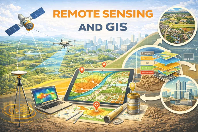
Remote Sensing and GIS banner
Preview this course

Remote Sensing and GIS

Remote Sensing and GIS banner
Preview this course
Self-paced Advanced

Remote Sensing and GIS

3(115)
2 enrolled
186 views
FREE
1345 min
Anytime
English
186 views
Engineering Academy
Engineering AcademyLearn Without Limits: Free Engineering Courses
  • Lifetime access
  • Certificate of completion
  • Anytime Learning
  • Learn from Industry Expert
Volume pricing for groups of 5+

Why enroll

This course is highly valuable for civil engineers, planners, and environmental professionals seeking to develop modern, data-driven skills. It helps learners analyze spatial patterns, monitor large areas efficiently, and support informed decision-making in projects related to smart cities, transportation networks, water resources, and environmental protection. The skills gained also enhance career opportunities in GIS, remote sensing, and geospatial analytics.

Is this course for you?

You should take this if

  • You work in Telecommunication or Aerospace
  • You're a Civil & Structural professional
  • You have 3+ years of hands-on experience in this field
  • You prefer self-paced learning you can revisit

You should skip if

  • You're new to this field with no prior experience
  • You need a different specialisation outside Civil & Structural
  • You need live interaction with an instructor

Course details

The Remote Sensing and GIS course introduces the principles of acquiring, processing, and analyzing spatial data for engineering and planning applications. It explains how satellite and aerial imagery are used alongside Geographic Information Systems (GIS) to capture, manage, analyze, and visualize geographic information. The course builds a strong foundation in spatial data concepts and their role in modern infrastructure and environmental projects.

The course covers the fundamentals of remote sensing, including sensors, platforms, and image interpretation, along with core GIS concepts such as spatial data models, map projections, and spatial analysis techniques. Emphasis is placed on practical applications in urban planning, transportation, water resources, environmental monitoring, and disaster management, enabling learners to understand how geospatial technologies support data-driven decision-making.

SOURCE- youtube[ NPTEL IIT Guwahati]

Course suitable for

Key topics covered

  1. Basics of remote sensing and electromagnetic spectrum

  2. Satellite platforms, sensors, and image acquisition

  3. Image preprocessing and enhancement techniques

  4. Image interpretation and classification

  5. Fundamentals of Geographic Information Systems (GIS)

  6. Spatial data models and map projections

  7. Spatial analysis and GIS tools

  8. Integration of remote sensing and GIS

  9. Applications in urban planning and transportation

  10. Environmental monitoring and disaster management

Course content

The course is readily available, allowing learners to start and complete it at their own pace.

24 lectures22 hr 25 min
  1. Lec 01: Overview and Introduction
    60 min
  2. Lec 02: Basics of Remote Sensing
    50 min
  3. Lec 03: Error corrections in satellite image
    64 min
  4. Lec 04: Error Identification and Correction - I
    61 min
  5. Lec 05: Error Identification and Correction - II
    51 min
  6. Lec 06: Error Identification and Correction - III
    60 min
  7. Lec 7: DIP-I
    54 min
  8. Lec 8: DIP-II
    65 min
  9. Lec 9: DIP-III
    54 min
  10. Lec 10: DIP-IV
    53 min
  11. Lec 11: Image Classification-I
    77 min
  12. Lec 12: Image Classification-II
    53 min
  13. Lec 13: Photogrammetry
    60 min
  14. Lec 14: Thermal Remote Sensing
    67 min
  15. Lec 15: Microwave Remote Sensing
    62 min
  16. Lec 16: HRS-I
    72 min
  17. Lec 17: HRS-II
    55 min
  18. Lec 18: HRS-III
    49 min
  19. Lec 19: HRS-IV
    54 min
  20. Lec 20: HRS-V
    33 min
  21. Lec 21: GIS-I
    55 min
  22. Lec 22: GIS-II
    58 min
  23. Lec 23: Applications of Remote Sensing & GIS-I
    35 min
  24. Lec 24: Applications of Remote Sensing & GIS-II
    43 min

Opportunities that await you!

Career opportunities

FREE

Access anytime

Questions and Answers

A: The 2.5% gain change is the tripwire. NDVI cancels offset well, not gain, and the error scales with surface reflectance. That's why vegetated and bright soils shift upward together, distorting trends. Without recalibrating the radiometry, downstream corrections just hide the bias rather than removing it, and cert won't buy that.

A: The 10 µm pitch is the boundary detail people drop. GSD ≈ H × p / f = 620,000 m × 10e-6 m / 7.5 m ≈ 0.83 m. Curvature and slant range don't enter at nadir for first-order cert math, and unit mistakes inflate the answer by an order of magnitude.

A: The ±0.5 m threshold kills most global products. Vegetation adds bias that optical stereo and InSAR struggle with unless heavily corrected. High-density airborne LiDAR, leaf-off, is the only option that clears CE90 consistently in flat, vegetated floodplains.

A: The boundary is user risk, not formatting. ISO 19115 exists so uncertainty travels with the data. Without stated accuracy, analysts make silent assumptions that can break safety cases, especially when layers are fused.